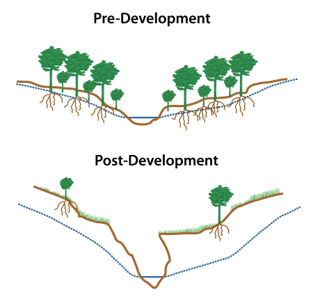
Changes in stream channel shape after development
This diagram shows changes in stream channel shape, floodplain, and water table after development of the floodplain.

Usage Statement:
Creative Commons BY-NC-SA
This item has a Creative Commons license for re-use. This Creative Commons BY-NC-SA license means that you may use, remix, tweak, and build upon the work for non-commerical purposes as long as you credit the original creator and as long as you license your new creation using the same license. For more information about Creative Commons licensing and a link to the license, see full details at https://creativecommons.org/licenses/by-nc-sa/4.0/.